
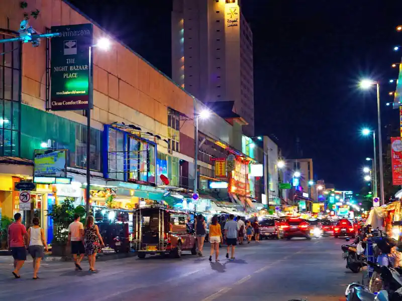
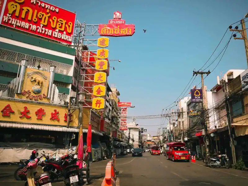
Our massage studio, Kunlarat Massage, is located on Chang Khlan Road. Situated just east of the Old City, it has traditionally been regarded as Chiang Mai’s primary commercial artery. The area is home to the famous Warorot Market and numerous smaller marketplaces that merge each evening to form the iconic Night Bazaar.
Chang Khlan is also, unfortunately, known for its vulnerability to the Ping River. Flooding typically threatens the area in September and October, toward the end of the rainy season, when months of sustained rainfall have already saturated the ground and filled upstream reservoirs to capacity.
At such times, local news outlets closely monitor the water level at Nawarat Bridge (P.1 gauge station): when it approaches 3.7 meters, residents begin moving their belongings to upper floors and stacking sandbags at building entrances.
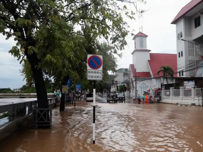
This is what Chang Khlan looked like on the morning of October 5, 2024, when the river level reached around 5.30 meters, a record high for many years. We had planned to stay in the studio overnight to bail out any seepage, but the floodwaters eventually overtopped the sandbags, submerging the studio to a depth of about one meter. By morning, wading through a surprisingly strong current, we made our way home through the flooded streets.
So why was Chiang Mai’s premier commercial district built in such a flood-prone location? Let’s dive into the history.
Why Chiang Mai Was Built Where It Is
Historical Chiang Mai, enclosed by walls with towers and a moat — what we now call the “Old City” — was deliberately built at a distance from the Ping River for a reason. To the west of the river there used to be a swampy, low-lying floodplain where water from Doi Suthep mountain would flow, turning the area into a seasonal lake during the rainy season.
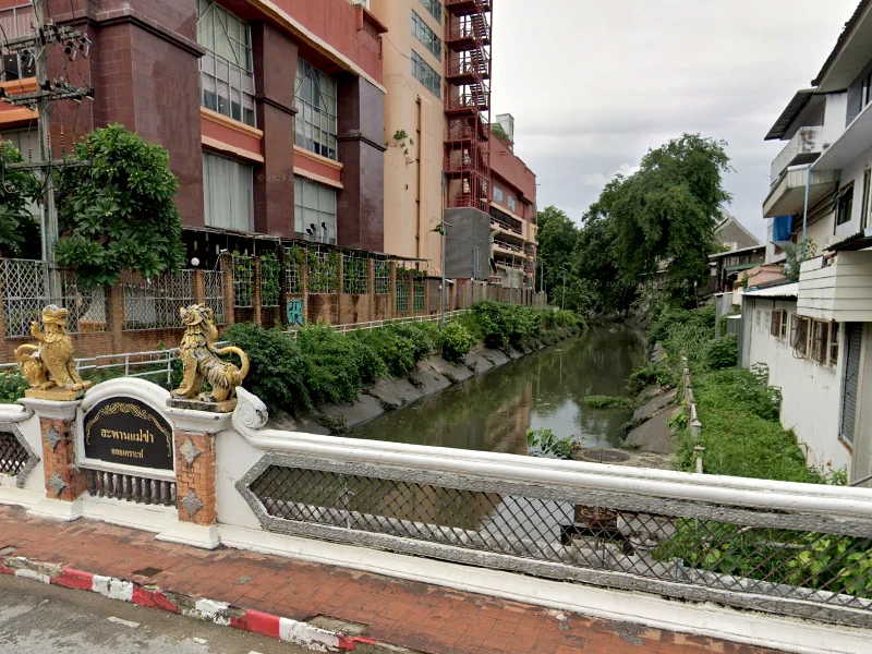
To reclaim some of this land, the Mae Kha Canal was dug parallel to the river in the 19th century. You’ve likely seen it if you’ve wandered east of the Old City — for instance, on Loi Kroh Road, where it’s spanned by a bridge adorned with lion statues.
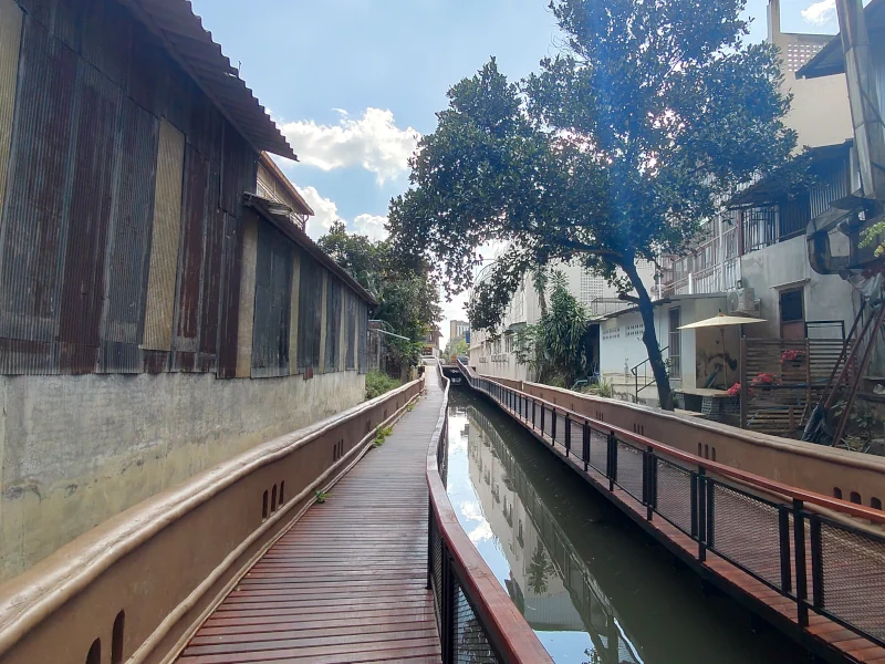
Until the past few years, the Mae Kha Canal was little more than an overgrown, rubbish-filled ditch hidden behind buildings. Recently, however, the city has begun turning it into a new urban attraction.
In 2022, the Mae Kha Canal Walking Street was created, and by 2026 a much longer section through the city center had been redesigned as a continuous waterside promenade.
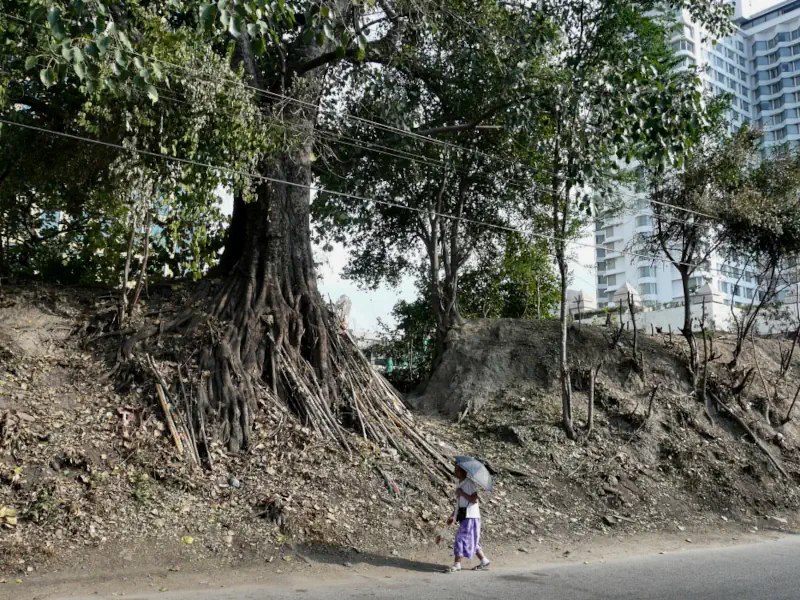
The earth excavated from the canal formed a city rampart, and the street running along its inner side is still called Kampeng Din, meaning “Earth Wall.” You may have noticed the tree-covered remnants of this rampart near the bridge with lion statues.
Since its creation, the Mae Kha Canal and Kampeng Din Street have separated the flood-prone parts of Chiang Mai from areas that almost never flood.
Over time, the rampart and canal took on another role: when they became overgrown with trees and bushes, Kampeng Din Street became home to numerous brothels with back exits leading into the dense, rubbish-filled thickets where police rarely ventured. Sex workers and their clients could hide there during nighttime raids. But that’s a story for another time!
Within the fortified walls and moats of the “sacred city,” the Lanna-Thai elite and monasteries resided. The land east of Thapae Gate, up to the earth wall and canal, served as a suburb, while the area along the wall was considered the city’s seedy outskirts. The flood-prone lands east of the canal, stretching to the Ping River, were deemed undesirable and even “impure,” with no permanent residents.
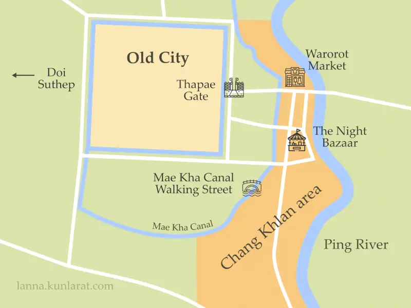
Why the Area Is Called “Chang Khlan”
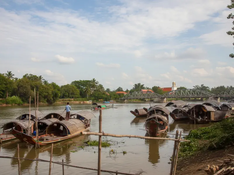
Meanwhile, at the site of the current pedestrian near the Flower Market, there were landing places where goods were transferred from elephants to boats and vice versa. Elephant caravans arrived from Burma, while boats came from Siam (first Ayutthaya, then Bangkok). Over time, this place developed into what is now Warorot Market.
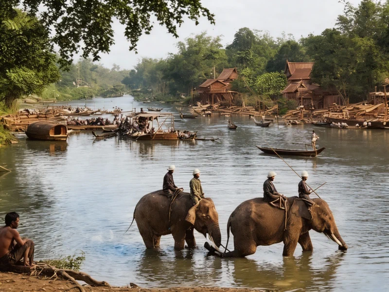
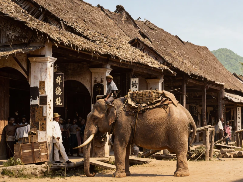
The name “Chang Khlan” (“ช้างคลาน”), originally referring to the entire low-lying strip of land between the Mae Kha Canal and the Ping River, translates from Thai as “crawling elephants.” The roads here were so muddy and rutted that elephants had to slog through belly-deep muck.
Later, the name became associated with the main road in the district, running south from Warorot Market parallel to the river and canal.
How Chang Khlan became foreigners neighborhood
In the late 19th and early 20th centuries, Chiang Mai saw an influx of foreign traders: Muslim Chinese from Yunnan province, Teochew Chinese from Guangdong province, and Indian textile merchants—Hindus, Muslims, and Sikhs.
The Thai administration allocated land for these “aliens” (ต่างด้าว) outside the Thai city, along the Ping River. These communities formed distinct neighborhoods along Chang Khlan Road, each with their own temples, which still indicate who lived where.
The first foreign traders in Chiang Mai were forced to build their homes and warehouses on stilts or raised platforms, and keep boats on hand. Over time, however, they established deep roots and prospered—especially the Teochew Chinese clans, renowned for their tireless industry and entrepreneurial spirit.
By the second half of the 20th century, their descendants replaced the old wooden stalls with enduring concrete structures. The rise of Warorot, Ton Lam Yai, and Anusarn markets, along with other major shopping hubs, transformed the northern end of Chang Khlan Road into the city’s most iconic commercial district.
Europeans were also granted land solely along the Ping River. As a result, Chiang Mai’s oldest foreign consulates, Christian churches, and international schools are now located in this area.
The riverside restaurants in historic colonial-style buildings on the eastern bank of the river, north of Nawarat Bridge and opposite the Flower Market, were once part of the “missionary quarter” centered around the American First Church of Chiang Mai.
The former British Consulate building (closed in 1978) is now part of the Anantara Chiang Mai Resort, where it also houses a bar and restaurant.
