Lanna Atlas / Hiking / Doi Nang Moh
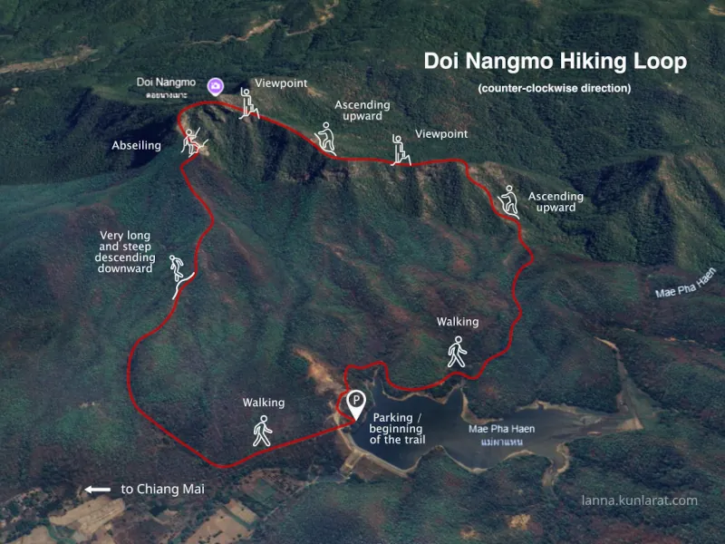
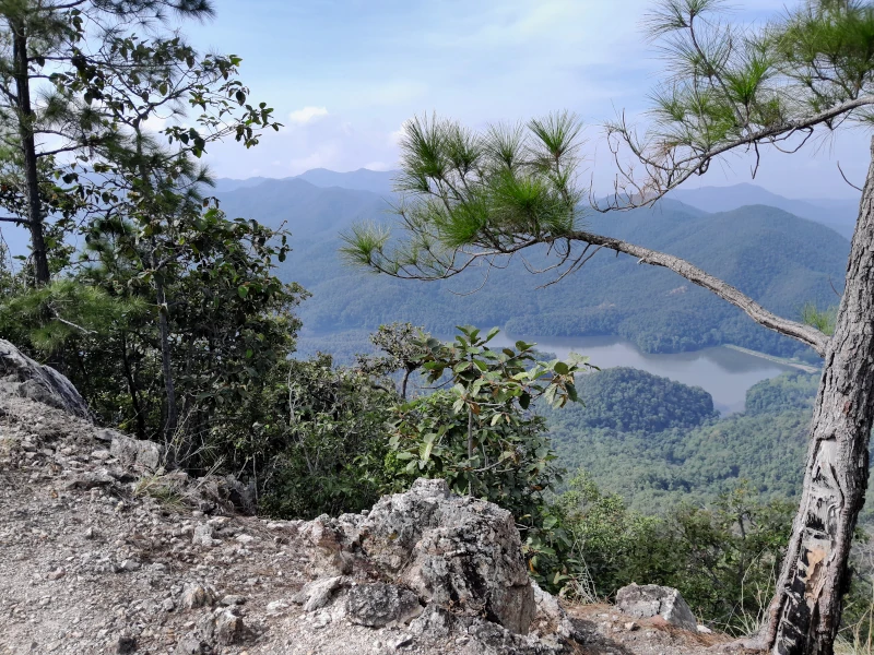
The rocky ridge of Nangmo Mountain, located 30 kilometers east of Chiang Mai city center, offers a panoramic view of Mae On District and Doi Suthep Mountain. This 8.8-kilometer loop trail is considered challenging due to a section where hikers must descend (or ascend, depending on the direction) a vertical cliff using a rope.
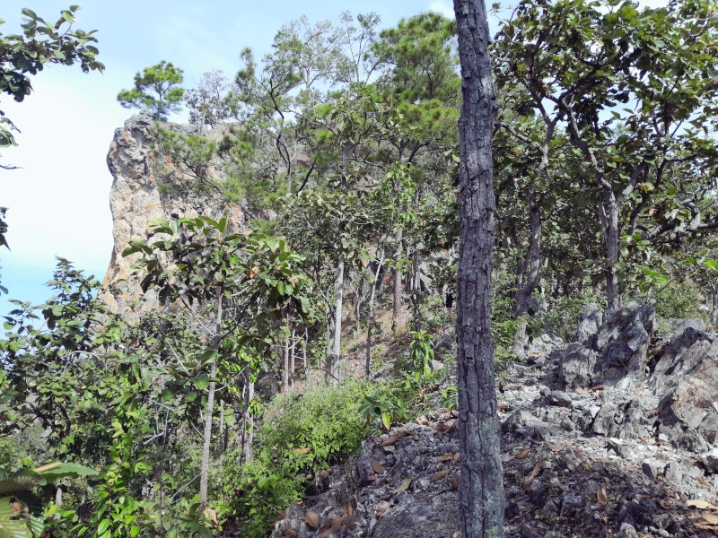
Compounding the difficulty is the fact that this forested area is not part of any national park but rather community land, which allows free access for all visitors. Consequently, the trail’s markings rely solely on the efforts of hiking enthusiasts.
In keeping with common practice in Thailand, the trail is marked with ribbons tied to trees along its length. However, many of these markers have become weathered and faded from prolonged exposure. In some areas, handmade signs provide additional guidance.
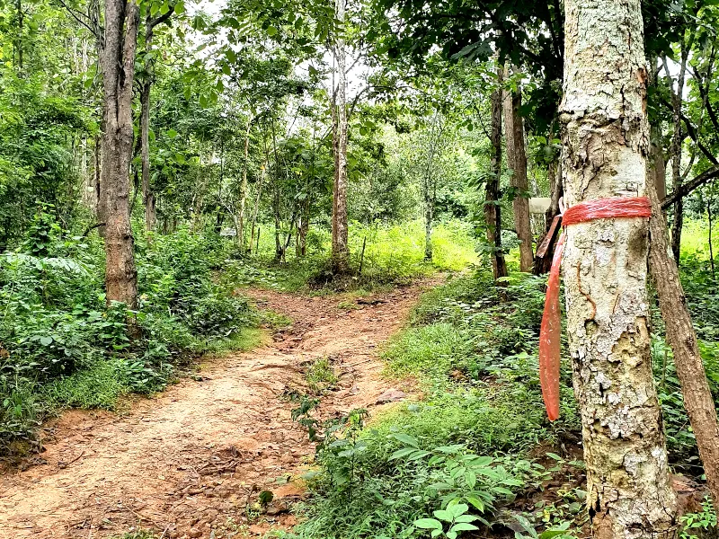
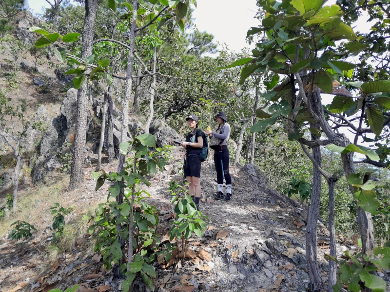
At the ridge itself, the path is straightforward and devoid of forks. However, in the lower flatlands, numerous side paths created by locals can make navigation tricky. At several junctions, it may be unclear which path leads to the ascent or back to the starting point at the parking area near the reservoir.
For this hike, it is advisable to bring a fully charged phone with navigation apps installed (such as Komoot, AllTrails, or Maps.me). Without them, you risk getting lost on the forest paths, same as these hikers in July 2024. Fortunately, mobile signal reception remains strong throughout the entire route.
The hiking loop begins at the Pa Haen Reservoir parking lot. If you choose to go in a counterclockwise direction, as most hikers do, your journey starts with a walk of just over a kilometer along the reservoir’s shoreline before turning into the forest. Note that as of November 2024, neither the trailhead—located north of the parking area—nor the turn into the forest were marked; thus, GPS navigation will be essential from the outset.
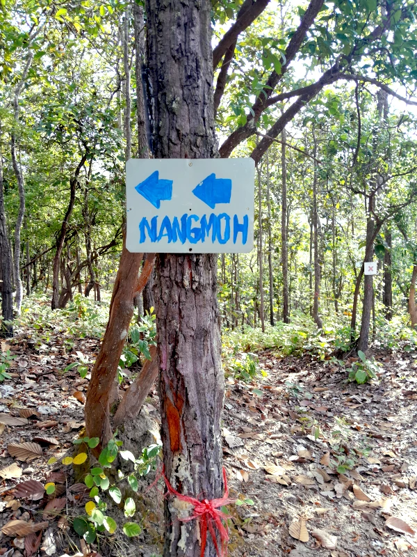
The forest path gradually ascends for about 2 kilometers. Be sure to watch for a fork where you’ll need to take the left-hand path marked with a “Nangmoh” sign featuring arrows.

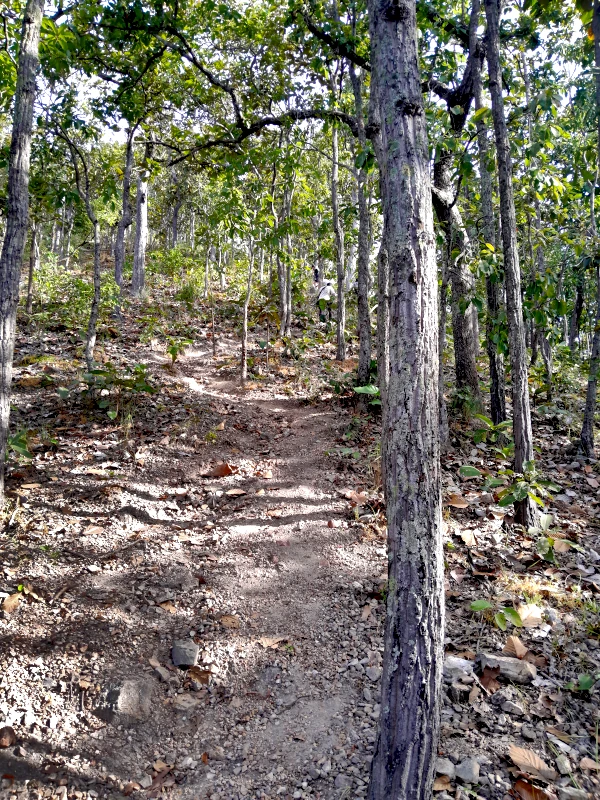
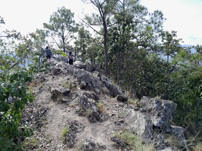
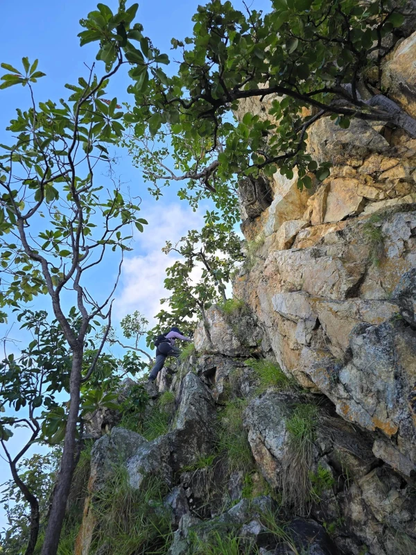
After a relatively short but steep climb, you will find yourself on a narrow path running along the main ridge, offering spectacular views on both sides. While some believe that this ridge is a collapsed crater of an ancient volcano, this is actually not the case.
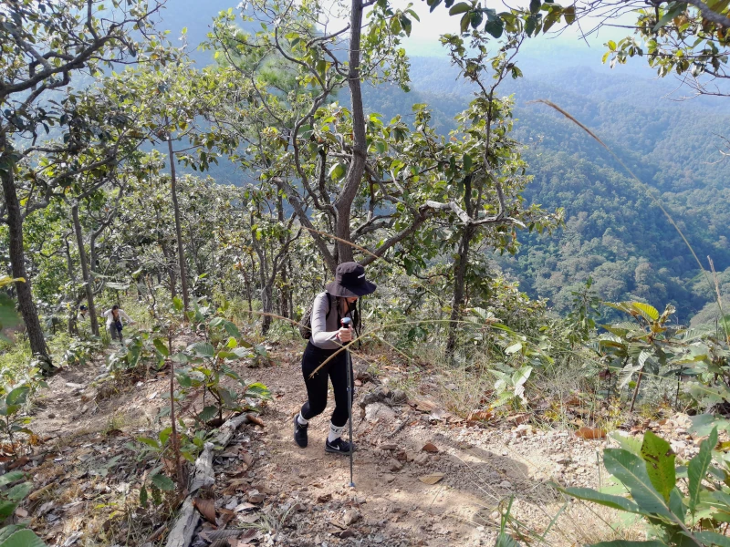
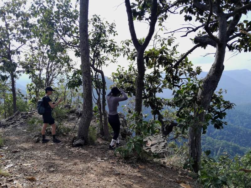
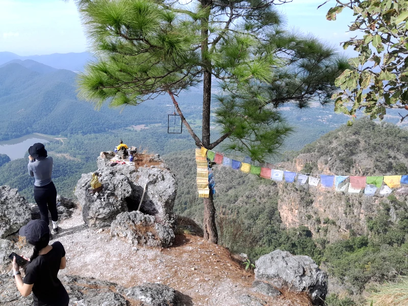
Winding your way through through sharp rock formations, not far from the top of Doi Nangmo you will encounter a viewing platform with a small altar featuring a statue of Buddha. This spot is particularly popular for selfies along the route.
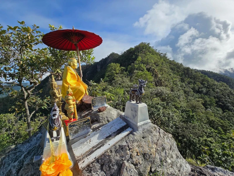
Another Buddhist altar is located at the very summit of Mount Nangmo.
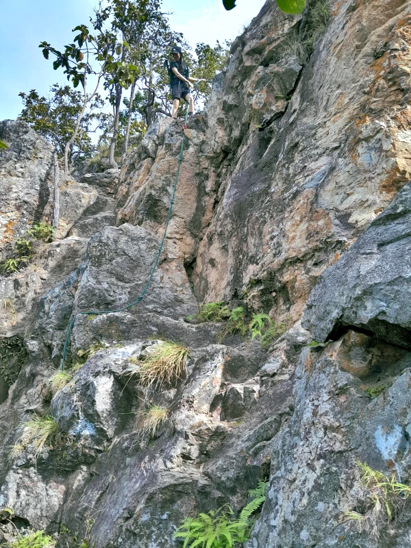
Following your time at the summit, you will begin a long descent into the valley. Along this path lies your main challenge: descending a low but nearly vertical cliff using a rope fixed in place.
As you continue down the trail, you will eventually reach an asphalt road where you should turn left and walk another 500 meters back to the parking lot.
Getting There
The reservoir parking lot is accessible only by private transport. If you plan to use Grab or Bolt services, keep in mind that finding a taxi to return to Chiang Mai may be difficult.
The good news is that most of your journey from Chiang Mai to Doi Nangmo will be along excellent multi-lane Highway 1317, allowing you to reach central Chiang Mai in under an hour.
Roman Brunner