
About the area
Doi Nang Mo (ดอยนางเมาะ) is located about a thirty-minute drive southeast of Chiang Mai. It is part of the massive Khun Tan mountain range, which separates Chiang Mai Province from Lampang Province and the main body of Thailand.
The Khun Tan Range is literally dotted with attractions—hot springs, waterfalls, and hiking trails—which makes it a popular destination for outdoor activities for both locals and foreign visitors. On the western slope, in Chiang Mai Province, the mountainous forest areas, including Doi Nang Mo, fall within Mae Takhrai National Park. On the eastern slope, in Lampang Province, lie Doi Khun Tan and Chae Son National Parks.
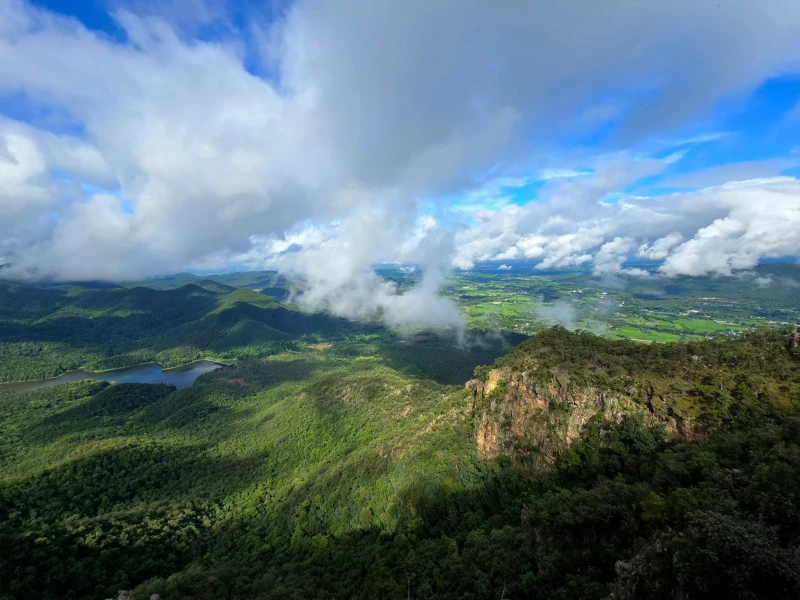
Its proximity to the city and its unusual shape—Doi Nang Mo resembles a collapsed volcano with a lake where the crater would be—attract large numbers of hikers. In reports by Thai travelers, it is often referred to as the “Fuji of Chiang Mai”, though in my view this is a significant exaggeration. In reality, Doi Nang Mo is a karst peak shaped by rain erosion, and the lake is a man-made reservoir.
The name translates as “mountain” (doi) of a “lady” (nang) named “Mo,” and it clearly relates to the northern Thai tradition of naming mountain peaks after female guardian spirits. These mountain spirits—most often princesses from legends of love, betrayal, or natural beauty—are generally benevolent: they protect the forests and assist travelers, but expect offerings such as flowers and incense in return.
Pre-registration and navigation
Despite being part of a national park, access to Nangmo Mountain is (for now) completely free—there are no checkpoints and no entrance fees. The only reminder of official rules is an information board at the parking area asking visitors to register by phone before heading out on the trail:
Mae Takhrai National Park Announcement Regarding request for cooperation in pre-registration before trekking
Currently, trekking is popular, so many Thai and foreign tourists have come to trek on the Doi Nang Moh nature trail in Mae Takhrai National Park in On Tai Subdistrict, San Kamphaeng District, Chiang Mai Province without informing the park. Sometimes, people get injured or get lost in the forest, or it may cause danger to the life and property of tourists. Mae Takhrai National Park would like to ask for cooperation from all tourists to please register with Mae Takhrai National Park in advance to prevent danger to tourists or to provide timely assistance. At the tourist service center, tel. 052 000 870, Mae Takhrai National Park Protection Unit at M.K. 4 (Mae Pha Haen), tel. 098 006 9710, 061 901 3110 Mayor of On Tai Subdistrict, tel. 094 709 7730, Headman of On Tai Subdistrict, tel. 084 378 4252 therefore, this is announced for general information.
If you enter the area without permission, you will be fined!
Mae Takhrai National Park, Chiang Mai and Lamphun provinces
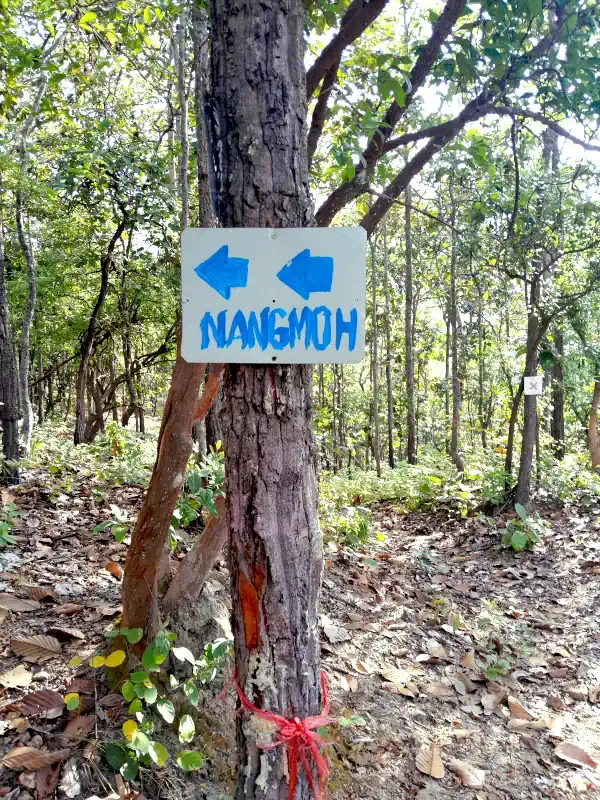
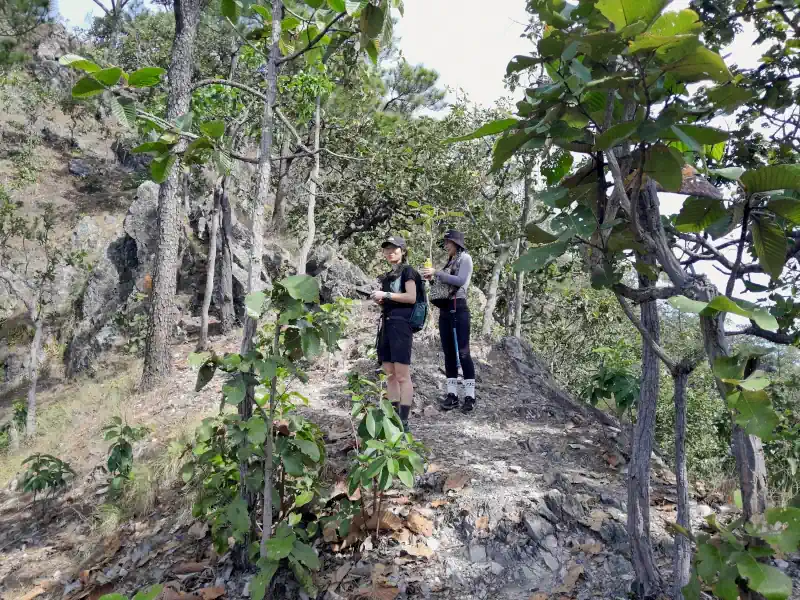
For now, this is the extent of the park administration’s care for visitors. Trail markings appear to rely entirely on the efforts of hiking enthusiasts themselves. As is common in Thailand, the route is marked with yellow or red ribbons tied to trees along the way. Many of these markers, however, have faded after long exposure to sun and rain. In a few sections, handmade signs offer some additional guidance.
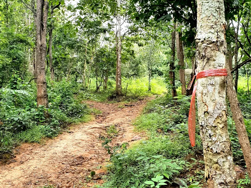
Along the ridge itself, the path is clear and free of forks. In the lower, flatter sections, however, numerous side trails created by local residents can make navigation confusing. At several junctions, it may be difficult to determine which path leads uphill and which returns to the starting point near the reservoir parking area.
For this hike, it is advisable to bring a fully charged phone with navigation apps installed (such as Komoot, AllTrails, or Maps.me). Without them, there is a real risk of getting lost among the forest trails—as happened to these hikers in July 2024. Fortunately, mobile signal coverage remains strong along the entire route.
Hiking trail
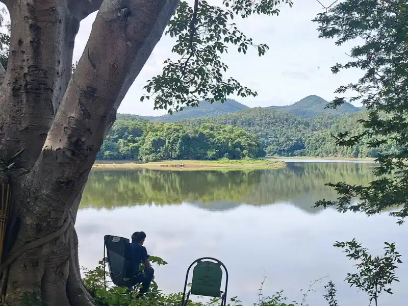
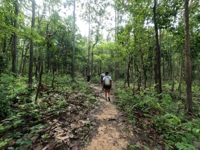
The hiking loop begins at the Pa Haen Reservoir parking lot. If you choose to go in a counterclockwise direction, as most hikers do, your journey starts with a walk of just over a kilometer along the reservoir’s shoreline before turning into the forest.
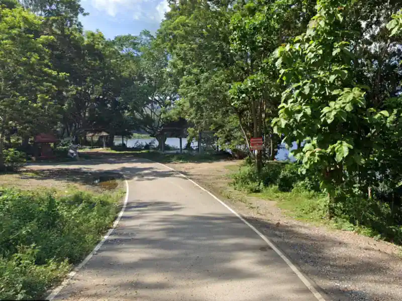
Note that as of November 2024, neither the trailhead—located north of the parking area—nor the turn into the forest were marked; thus, GPS navigation will be essential from the outset.
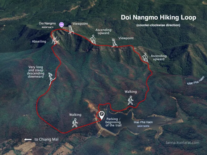
The forest path gradually ascends for about 2 kilometers. Be sure to watch for a fork where you’ll need to take the left-hand path marked with a “Nangmoh” sign featuring arrows.
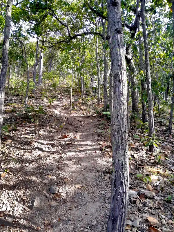
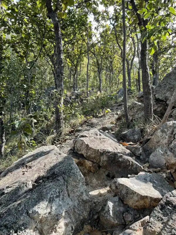
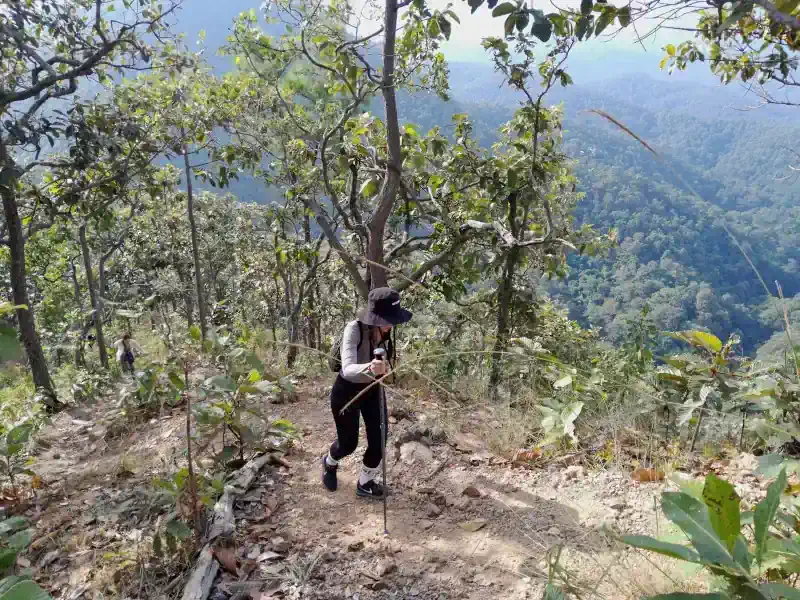
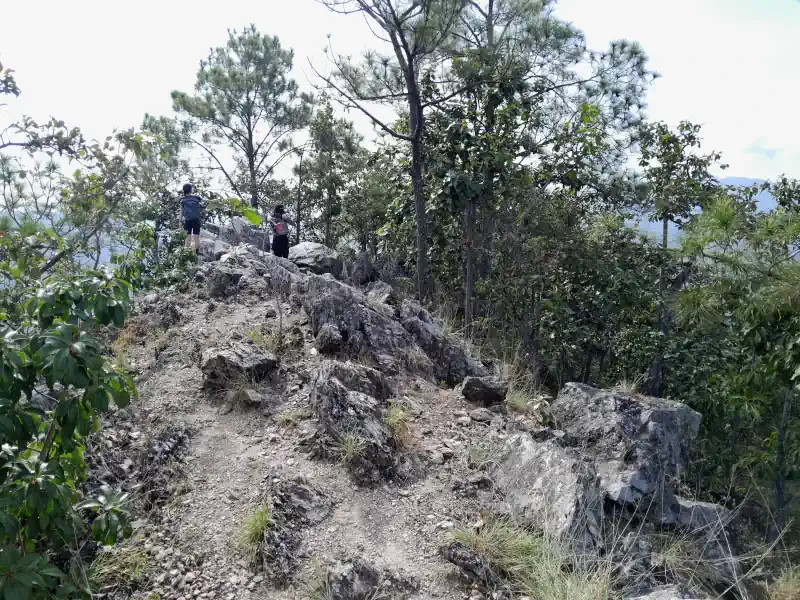
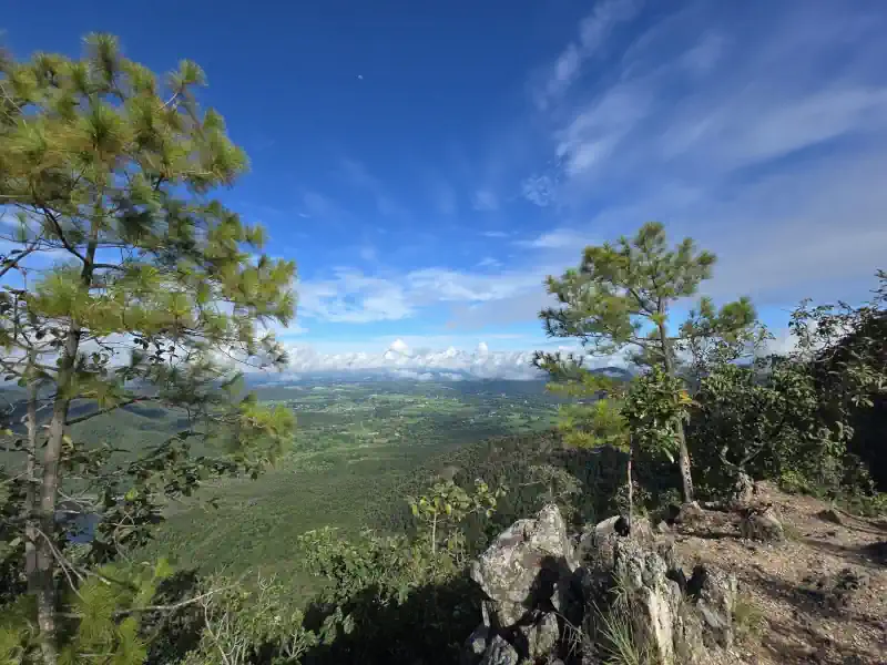
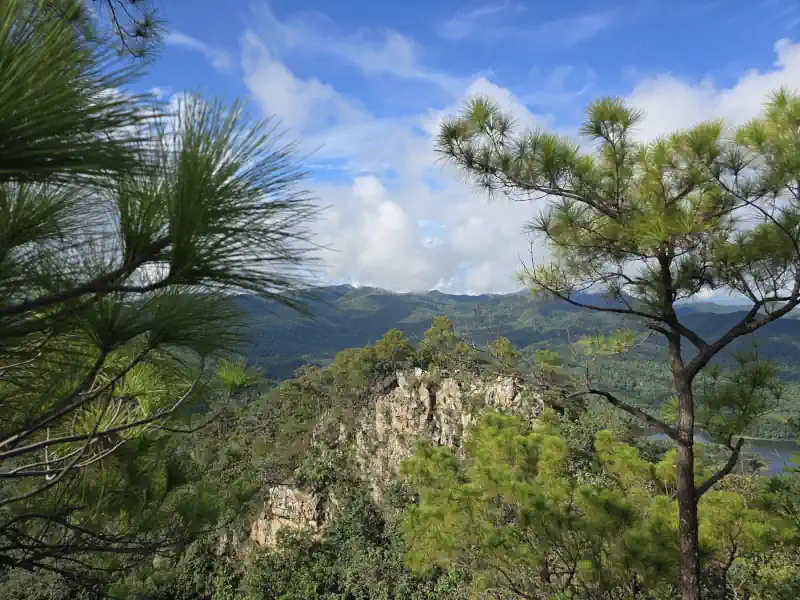
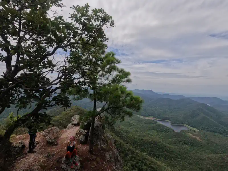
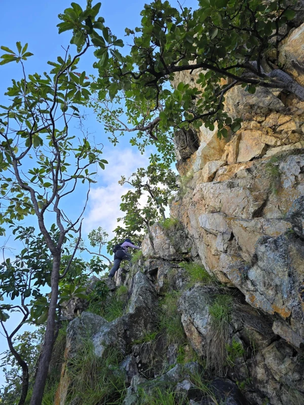
After a relatively short but steep climb, you will find yourself on a narrow path running along the main ridge.
While some believe that this ridge is a collapsed crater of an ancient volcano, this is actually not the case.
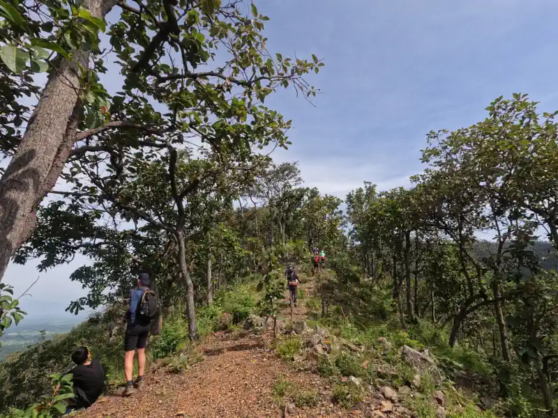
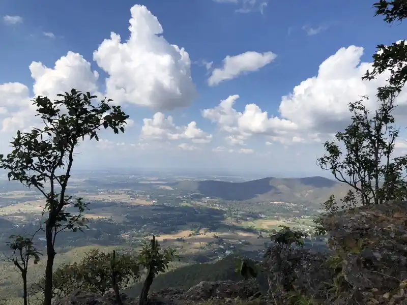
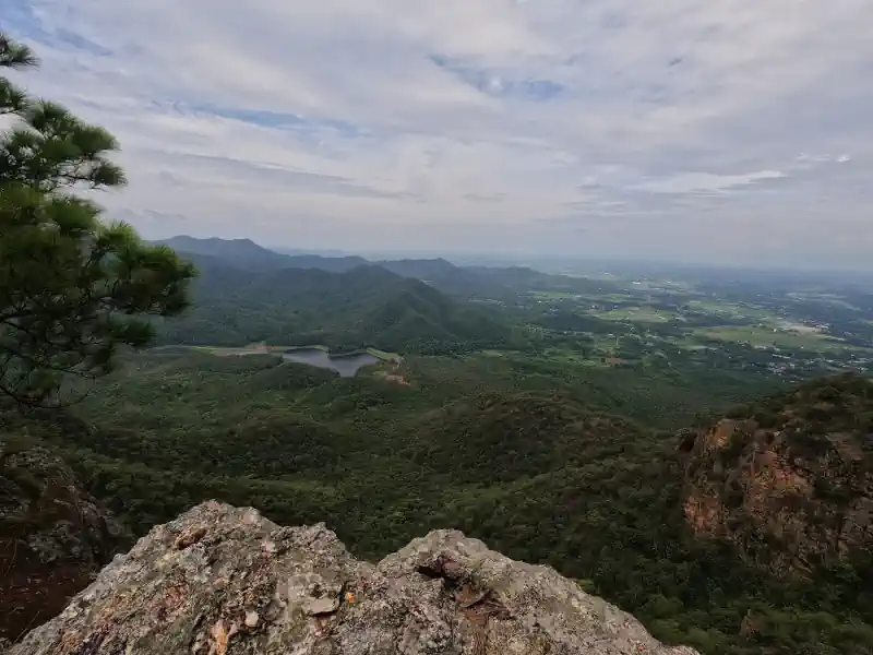
The trail is winding through through sharp rock formations, and going up and down.
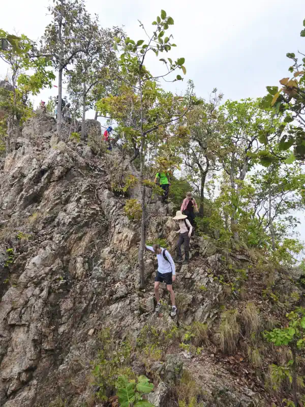
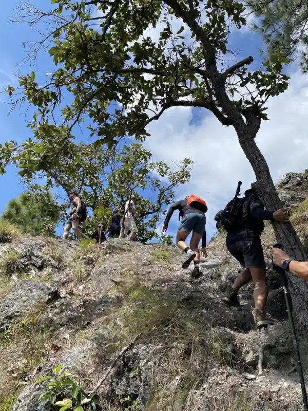
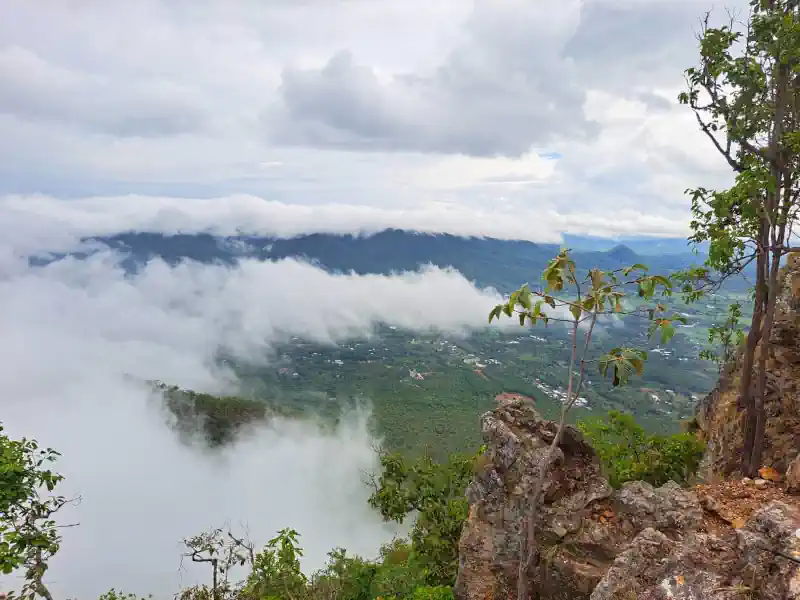
There are spectacular views on both sides.
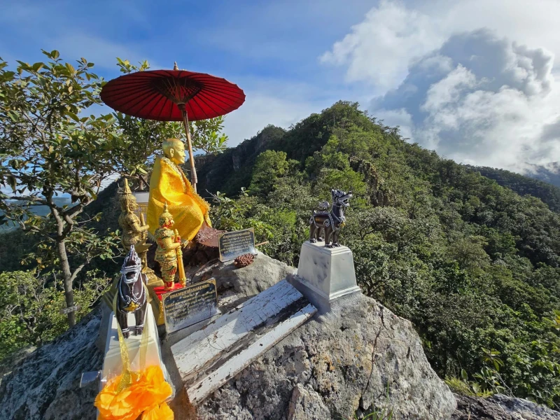
The usual spot for the first halt — a viewing platform with a small shrine featuring a Buddha statue, prayer flags, and offerings under an umbrella. This spot is particularly popular for selfies along the route.
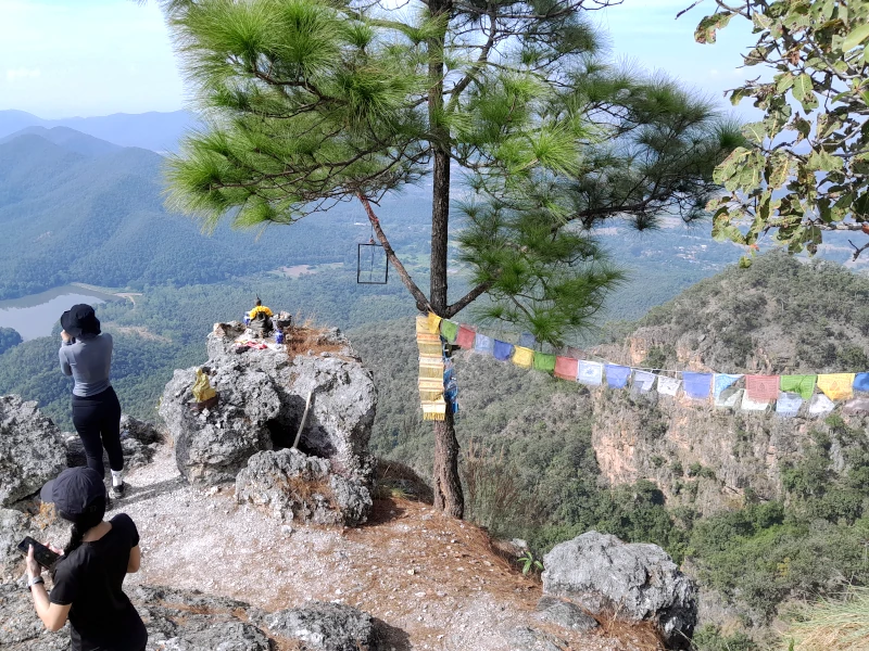
Another Buddhist altar is located at the very summit of Mount Nangmo.
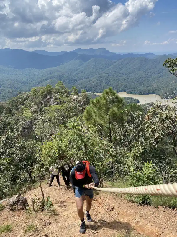
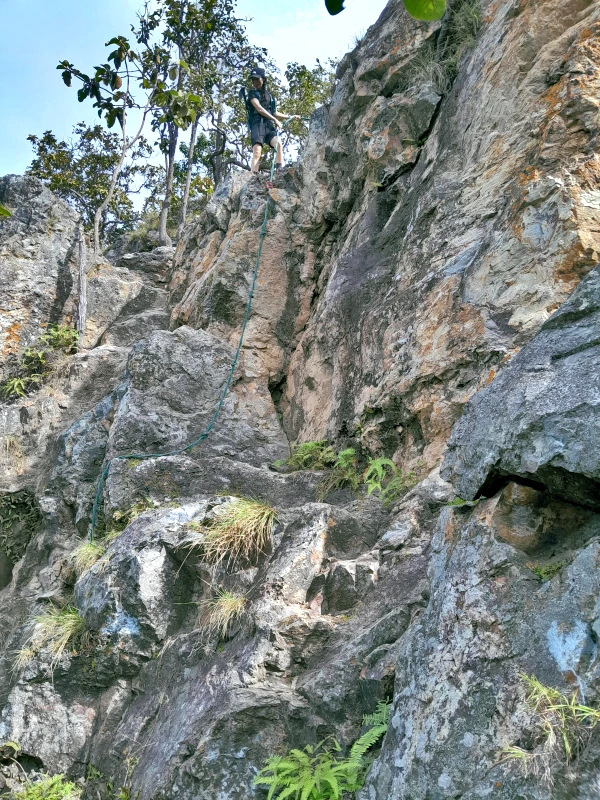
Following your time at the summit, you will begin a long descent into the valley. Along this path lies your main challenge: descending a low but nearly vertical cliff using a rope fixed in place.
As you continue down the trail, you will eventually reach an asphalt road where you should turn left and walk another 500 meters back to the parking lot.
Getting There
The reservoir parking lot is accessible only by private transport. If you plan to use Grab or Bolt services, keep in mind that finding a taxi to return to Chiang Mai may be difficult.
The good news is that most of your journey from Chiang Mai to Doi Nangmo will be along excellent multi-lane Highway 1317, allowing you to reach central Chiang Mai in under an hour.

Roman Brunner